JavaScript is disabled for your browser. Some features of this site may not work without it.
- ResearchSpace
- →
- Research Publications/Outputs
- →
- Conference Publications
- →
- View Item
| dc.contributor.author |
Schmitz, P

|
|
| dc.date.accessioned | 2008-12-03T11:22:55Z | |
| dc.date.available | 2008-12-03T11:22:55Z | |
| dc.date.issued | 2008-11 | |
| dc.identifier.citation | Schmitz, P. 2008. Using GIS as a forensic tool: 10 years of CSIR involvement. Science real and relevant. 2nd CSIR Biennial Conference, Pretoria, South Africa, 17-18 November 2008, pp 1 | en |
| dc.identifier.uri | http://hdl.handle.net/10204/2648 | |
| dc.description | Science real and relevant. 2nd CSIR Biennial Conference, Pretoria, South Africa, 17-18 November 2008 | en |
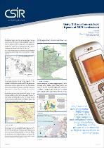
| dc.description.abstract | Use of GIS as a forensic tool to determine linkages and movement of criminals before during and after commiting crimes. Using cellular data to determine acticvity space and possible routes used by criminals | en |
| dc.language.iso | en | en |
| dc.publisher | CSIR | en |
| dc.subject | GIS | en |
| dc.subject | Forensic analysis | en |
| dc.subject | Cellphone data | en |
| dc.subject | Mapping | en |
| dc.title | Using GIS as a forensic tool: 10 years of CSIR involvement | en |
| dc.type | Conference Presentation | en |
| dc.identifier.apacitation | Schmitz, P. (2008). Using GIS as a forensic tool: 10 years of CSIR involvement. CSIR. http://hdl.handle.net/10204/2648 | en_ZA |
| dc.identifier.chicagocitation | Schmitz, P. "Using GIS as a forensic tool: 10 years of CSIR involvement." (2008): http://hdl.handle.net/10204/2648 | en_ZA |
| dc.identifier.vancouvercitation | Schmitz P, Using GIS as a forensic tool: 10 years of CSIR involvement; CSIR; 2008. http://hdl.handle.net/10204/2648 . | en_ZA |
| dc.identifier.ris | TY - Conference Presentation AU - Schmitz, P AB - Use of GIS as a forensic tool to determine linkages and movement of criminals before during and after commiting crimes. Using cellular data to determine acticvity space and possible routes used by criminals DA - 2008-11 DB - ResearchSpace DP - CSIR KW - GIS KW - Forensic analysis KW - Cellphone data KW - Mapping LK - https://researchspace.csir.co.za PY - 2008 T1 - Using GIS as a forensic tool: 10 years of CSIR involvement TI - Using GIS as a forensic tool: 10 years of CSIR involvement UR - http://hdl.handle.net/10204/2648 ER - | en_ZA |