JavaScript is disabled for your browser. Some features of this site may not work without it.
- ResearchSpace
- →
- Research Publications/Outputs
- →
- Conference Publications
- →
- View Item
| dc.contributor.author |
Mafiri, MT

|
|
| dc.contributor.author |
Nyareli, T
|
|
| dc.contributor.author |
Ngwenya, B
|
|
| dc.contributor.author |
Vogt, D
|
|
| dc.date.accessioned | 2008-11-26T07:48:03Z | |
| dc.date.available | 2008-11-26T07:48:03Z | |
| dc.date.issued | 2008-11 | |
| dc.identifier.citation | Mafiri, MT, Nyareli, T, Ngwenya, B and Vogt, D. 2008. Borehole radar as a tool to optimise mine layouts and production. Science real and relevant: 2nd CSIR Biennial Conference, CSIR International Convention Centre Pretoria, 17 & 18 November 2008, pp 1 | en |
| dc.identifier.isbn | 978-0-7988-5573-0 | en |
| dc.identifier.uri | http://hdl.handle.net/10204/2630 | |
| dc.description | Science real and relevant: 2nd CSIR Biennial Conference, CSIR International Convention Centre Pretoria, 17 & 18 November 2008 | en |
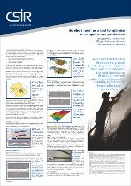
| dc.description.abstract | The major gold and platinum deposits of South Africa occur in the Witwatersrand Basin (gold) and Bushveld Complex (platinum) (Henning et al., 1994; Carr et al., 1994; Cawthorn, 1999). While the origins and geology of the two structures have almost nothing in common, the resulting orebodies, known locally as reefs, share a number of physical similarities: They are thin, typically centimetres to a metre thick; they are shallow dipping, typically with dips of 5° to 30°; they are of great lateral extent; and they are tabular in geometry. In both cases, the reefs appear flat on a regional scale, but have significant topography on a local scale. Bushveld platinum mines are disrupted by potholes and iron-rich ultramafic pegmatite bodies (IRUPs), gold mines by rolls and channels, and both face the geological challenges of faults, joints and dykes. Figure 1 shows a convention mine layout that still dominates the gold and platinum industries, however, some mines are now mechanised. The overall mine layout can be designed from an understanding of the regional geology. Originally, this came from drilling, but it is now mostly from 3D seismic surveys that are limited by low resolution. When it comes to the actual mining of the reef higher resolution is required, and borehole radar (BHR) can offer the higher resolution | en |
| dc.language.iso | en | en |
| dc.publisher | CSIR | en |
| dc.subject | Borehole radar | en |
| dc.subject | Mines | en |
| dc.subject | Geometry | en |
| dc.title | Borehole radar as a tool to optimise mine layouts and production | en |
| dc.type | Conference Presentation | en |
| dc.identifier.apacitation | Mafiri, M., Nyareli, T., Ngwenya, B., & Vogt, D. (2008). Borehole radar as a tool to optimise mine layouts and production. CSIR. http://hdl.handle.net/10204/2630 | en_ZA |
| dc.identifier.chicagocitation | Mafiri, MT, T Nyareli, B Ngwenya, and D Vogt. "Borehole radar as a tool to optimise mine layouts and production." (2008): http://hdl.handle.net/10204/2630 | en_ZA |
| dc.identifier.vancouvercitation | Mafiri M, Nyareli T, Ngwenya B, Vogt D, Borehole radar as a tool to optimise mine layouts and production; CSIR; 2008. http://hdl.handle.net/10204/2630 . | en_ZA |
| dc.identifier.ris | TY - Conference Presentation AU - Mafiri, MT AU - Nyareli, T AU - Ngwenya, B AU - Vogt, D AB - The major gold and platinum deposits of South Africa occur in the Witwatersrand Basin (gold) and Bushveld Complex (platinum) (Henning et al., 1994; Carr et al., 1994; Cawthorn, 1999). While the origins and geology of the two structures have almost nothing in common, the resulting orebodies, known locally as reefs, share a number of physical similarities: They are thin, typically centimetres to a metre thick; they are shallow dipping, typically with dips of 5° to 30°; they are of great lateral extent; and they are tabular in geometry. In both cases, the reefs appear flat on a regional scale, but have significant topography on a local scale. Bushveld platinum mines are disrupted by potholes and iron-rich ultramafic pegmatite bodies (IRUPs), gold mines by rolls and channels, and both face the geological challenges of faults, joints and dykes. Figure 1 shows a convention mine layout that still dominates the gold and platinum industries, however, some mines are now mechanised. The overall mine layout can be designed from an understanding of the regional geology. Originally, this came from drilling, but it is now mostly from 3D seismic surveys that are limited by low resolution. When it comes to the actual mining of the reef higher resolution is required, and borehole radar (BHR) can offer the higher resolution DA - 2008-11 DB - ResearchSpace DP - CSIR KW - Borehole radar KW - Mines KW - Geometry LK - https://researchspace.csir.co.za PY - 2008 SM - 978-0-7988-5573-0 T1 - Borehole radar as a tool to optimise mine layouts and production TI - Borehole radar as a tool to optimise mine layouts and production UR - http://hdl.handle.net/10204/2630 ER - | en_ZA |