The use of satellite imagery for mapping coastal river plumes in the Marine Realm
JavaScript is disabled for your browser. Some features of this site may not work without it.
- ResearchSpace
- →
- Research Publications/Outputs
- →
- Journal Articles
- →
- View Item
| dc.contributor.author |
Mtetandaba, A

|
|
| dc.contributor.author |
Smith, Marie E
|
|
| dc.contributor.author |
Van Niekerk, Lara
|
|
| dc.contributor.author |
Sink, K
|
|
| dc.date.accessioned | 2022-11-21T08:42:19Z | |
| dc.date.available | 2022-11-21T08:42:19Z | |
| dc.date.issued | 2022-10 | |
| dc.identifier.citation | Mtetandaba, A., Smith, M.E., Van Niekerk, L. & Sink, K. 2022. The use of satellite imagery for mapping coastal river plumes in the Marine Realm. http://hdl.handle.net/10204/12528 . | en_ZA |
| dc.identifier.uri | http://hdl.handle.net/10204/12528 | |
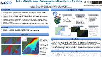
| dc.description.abstract | Freshwater flowing from rivers through estuaries into the marine realm maintains essential ecological processes that keep marine resources healthy by providing nutrients and sediments that form important habitats and underlie critical ecological processes. Plumes are readily observable as brown turbid water masses contrasting with the clearer saline seawater. The spatial scale and dynamic behavior of river plumes can be detected in satellite imagery to provide quantitative insights into freshwater discharge volume, sediment loads, plume extent, and plume duration. For this study turbidity act as proxy for freshwater discharge, and a substitute for water clarity. | en_US |
| dc.format | Fulltext | en_US |
| dc.language.iso | en | en_US |
| dc.source | WIOMSA symposium, Nelson Mandela Bay, 10-15 October 2022 | en_US |
| dc.subject | Luvial flows | en_US |
| dc.subject | Marine Realm | en_US |
| dc.subject | Coastal mapping | en_US |
| dc.subject | River plumes | en_US |
| dc.subject | Satellite imagery | en_US |
| dc.title | The use of satellite imagery for mapping coastal river plumes in the Marine Realm | en_US |
| dc.type | Conference Presentation | en_US |
| dc.description.pages | 1 | en_US |
| dc.description.note | Presented at the WIOMSA symposium, Nelson Mandela Bay, 10-15 October 2022 | en_US |
| dc.description.cluster | Smart Places | en_US |
| dc.description.impactarea | Coastal Systems | en_US |
| dc.identifier.apacitation | Mtetandaba, A., Smith, M. E., Van Niekerk, L., & Sink, K. (2022). The use of satellite imagery for mapping coastal river plumes in the Marine Realm. http://hdl.handle.net/10204/12528 | en_ZA |
| dc.identifier.chicagocitation | Mtetandaba, A, Marie E Smith, Lara Van Niekerk, and K Sink. "The use of satellite imagery for mapping coastal river plumes in the Marine Realm." <i>WIOMSA symposium, Nelson Mandela Bay, 10-15 October 2022</i> (2022): http://hdl.handle.net/10204/12528 | en_ZA |
| dc.identifier.vancouvercitation | Mtetandaba A, Smith ME, Van Niekerk L, Sink K, The use of satellite imagery for mapping coastal river plumes in the Marine Realm; 2022. http://hdl.handle.net/10204/12528 . | en_ZA |
| dc.identifier.ris | TY - Conference Presentation AU - Mtetandaba, A AU - Smith, Marie E AU - Van Niekerk, Lara AU - Sink, K AB - Freshwater flowing from rivers through estuaries into the marine realm maintains essential ecological processes that keep marine resources healthy by providing nutrients and sediments that form important habitats and underlie critical ecological processes. Plumes are readily observable as brown turbid water masses contrasting with the clearer saline seawater. The spatial scale and dynamic behavior of river plumes can be detected in satellite imagery to provide quantitative insights into freshwater discharge volume, sediment loads, plume extent, and plume duration. For this study turbidity act as proxy for freshwater discharge, and a substitute for water clarity. DA - 2022-10 DB - ResearchSpace DP - CSIR J1 - WIOMSA symposium, Nelson Mandela Bay, 10-15 October 2022 KW - Luvial flows KW - Marine Realm KW - Coastal mapping KW - River plumes KW - Satellite imagery LK - https://researchspace.csir.co.za PY - 2022 T1 - The use of satellite imagery for mapping coastal river plumes in the Marine Realm TI - The use of satellite imagery for mapping coastal river plumes in the Marine Realm UR - http://hdl.handle.net/10204/12528 ER - | en_ZA |
| dc.identifier.worklist | 26224 | en_US |