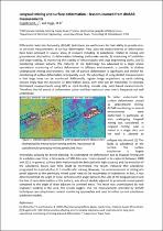
Longwall mining and surface deformation – lessons learned from dInSAR measurements
JavaScript is disabled for your browser. Some features of this site may not work without it.
- ResearchSpace
- →
- Research Publications/Outputs
- →
- Conference Publications
- →
- View Item
| dc.contributor.author |
Engelbrecht, Jeanine

|
|
| dc.contributor.author |
Inggs, MR
|
|
| dc.date.accessioned | 2017-06-07T07:09:01Z | |
| dc.date.available | 2017-06-07T07:09:01Z | |
| dc.date.issued | 2016-08 | |
| dc.identifier.citation | Engelbrecht, J. and Inggs, M.R. 2016. Longwall mining and surface deformation – lessons learned from dInSAR measurements. 35th International Geological Congress, 27 August - 4 September 2016, Cape Town, South Africa | en_US |
| dc.identifier.uri | https://www.americangeosciences.org/sites/default/files/igc/1757.pdf | |
| dc.identifier.uri | http://hdl.handle.net/10204/9166 | |
| dc.description | 35th International Geological Congress, 27 August - 4 September 2016, Cape Town, South Africa | en_US |
| dc.description.abstract | Differential radar interferometry (dInSAR) techniques are well known for their ability to provide mm- to cm-scale measurements of surface deformation. Very accurate measurements of deformation have been achieved in several areas of research including 1) subsidence related to mining and groundwater abstraction, 2) deformation following earthquake events, 3) monitoring of landslides and slope stability, 4) monitoring the stability of infrastructure and large engineering works, and 5) monitoring volcanic activity. The maturity of the technology has advanced to a stage where operational monitoring of surface deformation in different environments is possible. In shallow underground mining environments, the risk of surface deformation is significant and dInSAR for monitoring of surface deformation is frequently used. The advantage of using dInSAR measurements is that large areas can be monitored. Additionally, regular image acquisitions by earth orbiting sensors imply that the evolution of deformation basins over time can be monitored. In contrast, field-based measurements using GPS or spirit-levelling provide only point-based measurements. Therefore, the full extent of deformation basins and their evolution over time is frequently not well understood. | en_US |
| dc.language.iso | en | en_US |
| dc.publisher | American Geosciences Institute | en_US |
| dc.relation.ispartofseries | Worklist;18009 | |
| dc.subject | Differential radar interferometry | en_US |
| dc.subject | dInSAR | en_US |
| dc.subject | Surface deformation | en_US |
| dc.title | Longwall mining and surface deformation – lessons learned from dInSAR measurements | en_US |
| dc.type | Conference Presentation | en_US |
| dc.identifier.apacitation | Engelbrecht, J., & Inggs, M. (2016). Longwall mining and surface deformation – lessons learned from dInSAR measurements. American Geosciences Institute. http://hdl.handle.net/10204/9166 | en_ZA |
| dc.identifier.chicagocitation | Engelbrecht, Jeanine, and MR Inggs. "Longwall mining and surface deformation – lessons learned from dInSAR measurements." (2016): http://hdl.handle.net/10204/9166 | en_ZA |
| dc.identifier.vancouvercitation | Engelbrecht J, Inggs M, Longwall mining and surface deformation – lessons learned from dInSAR measurements; American Geosciences Institute; 2016. http://hdl.handle.net/10204/9166 . | en_ZA |
| dc.identifier.ris | TY - Conference Presentation AU - Engelbrecht, Jeanine AU - Inggs, MR AB - Differential radar interferometry (dInSAR) techniques are well known for their ability to provide mm- to cm-scale measurements of surface deformation. Very accurate measurements of deformation have been achieved in several areas of research including 1) subsidence related to mining and groundwater abstraction, 2) deformation following earthquake events, 3) monitoring of landslides and slope stability, 4) monitoring the stability of infrastructure and large engineering works, and 5) monitoring volcanic activity. The maturity of the technology has advanced to a stage where operational monitoring of surface deformation in different environments is possible. In shallow underground mining environments, the risk of surface deformation is significant and dInSAR for monitoring of surface deformation is frequently used. The advantage of using dInSAR measurements is that large areas can be monitored. Additionally, regular image acquisitions by earth orbiting sensors imply that the evolution of deformation basins over time can be monitored. In contrast, field-based measurements using GPS or spirit-levelling provide only point-based measurements. Therefore, the full extent of deformation basins and their evolution over time is frequently not well understood. DA - 2016-08 DB - ResearchSpace DP - CSIR KW - Differential radar interferometry KW - dInSAR KW - Surface deformation LK - https://researchspace.csir.co.za PY - 2016 T1 - Longwall mining and surface deformation – lessons learned from dInSAR measurements TI - Longwall mining and surface deformation – lessons learned from dInSAR measurements UR - http://hdl.handle.net/10204/9166 ER - | en_ZA |