 ResearchSpace
Extending the formal model of a spatial data infrastructure to include volunteered geographical information
JavaScript is disabled for your browser. Some features of this site may not work without it.
- ResearchSpace
- →
- Research Publications/Outputs
- →
- Conference Publications
- →
- View Item
| dc.contributor.author |
Cooper, Antony K

|
|
| dc.contributor.author |
Rapant, P

|
|
| dc.contributor.author |
Hjelmager, J

|
|
| dc.contributor.author |
Laurent, D

|
|
| dc.contributor.author |
Iwaniak, A

|
|
| dc.contributor.author |
Coetzee, S

|
|
| dc.contributor.author |
Moellering, H

|
|
| dc.contributor.author |
Düren, U

|
|
| dc.date.accessioned | 2011-10-10T08:36:00Z | |
| dc.date.available | 2011-10-10T08:36:00Z | |
| dc.date.issued | 2011-07 | |
| dc.identifier.citation | Cooper, AK, Rapant, P, Hjelmager, J et al. 2011. Extending the formal model of a spatial data infrastructure to include volunteered geographical information. 25th International Cartographic Conference (ICC 2011), Paris, France, 4-8 July 2011 | en_US |
| dc.identifier.uri | http://hdl.handle.net/10204/5212 | |
| dc.description | 25th International Cartographic Conference (ICC 2011), Paris, France, 4-8 July 2011 | en_US |
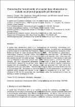
| dc.description.abstract | A spatial data infrastructure (SDI) is an evolving concept for facilitating, coordinating and monitoring the exchange and sharing of geospatial data and services. In earlier work, we developed a formal model for an SDI from the Enterprise, Information and Computational Viewpoints of the Reference Model for Open Distributed Processing (RM-ODP). We identified six stakeholders: Policy Maker, Producer, Provider, Broker, Value-added Reseller and End User. The Internet has spawned the development of virtual communities or virtual social networks, which share data with one another and with the public at large. This user-generated content is most obvious in web sites such as Wikipedia to which the general public, rather than domain experts, contribute information. Similarly, the term volunteered geographic information (VGI) is used for geospatial data contributed to datasets by the general public. Increasing costs of official mapping programmes coupled with the availability of high volumes of quality and up-to-date VGI, have led to the integration of VGI into some SDIs. Therefore it is necessary to rethink our formal model of an SDI to accommodate VGI. We started our rethinking process with the SDI stakeholders in an attempt to establish which changes are required to the stakeholders for including VGI in an SDI. The influence of VGI did not necessitate new stakeholders but rather the specialization of them, by defining a number of subtypes for each | en_US |
| dc.language.iso | en | en_US |
| dc.relation.ispartofseries | Workflow request;5014 | |
| dc.subject | Spatial data infrastructure | en_US |
| dc.subject | Cartographic ontology | en_US |
| dc.subject | Cartographic terminology | en_US |
| dc.subject | INSPIRE | en_US |
| dc.subject | Geographical information | en_US |
| dc.title | Extending the formal model of a spatial data infrastructure to include volunteered geographical information | en_US |
| dc.type | Conference Presentation | en_US |
| dc.identifier.apacitation | Cooper, A. K., Rapant, P., Hjelmager, J., Laurent, D., Iwaniak, A., Coetzee, S., ... Düren, U. (2011). Extending the formal model of a spatial data infrastructure to include volunteered geographical information. http://hdl.handle.net/10204/5212 | en_ZA |
| dc.identifier.chicagocitation | Cooper, Antony K, P Rapant, J Hjelmager, D Laurent, A Iwaniak, S Coetzee, H Moellering, and U Düren. "Extending the formal model of a spatial data infrastructure to include volunteered geographical information." (2011): http://hdl.handle.net/10204/5212 | en_ZA |
| dc.identifier.vancouvercitation | Cooper AK, Rapant P, Hjelmager J, Laurent D, Iwaniak A, Coetzee S, et al, Extending the formal model of a spatial data infrastructure to include volunteered geographical information; 2011. http://hdl.handle.net/10204/5212 . | en_ZA |
| dc.identifier.ris | TY - Conference Presentation AU - Cooper, Antony K AU - Rapant, P AU - Hjelmager, J AU - Laurent, D AU - Iwaniak, A AU - Coetzee, S AU - Moellering, H AU - Düren, U AB - A spatial data infrastructure (SDI) is an evolving concept for facilitating, coordinating and monitoring the exchange and sharing of geospatial data and services. In earlier work, we developed a formal model for an SDI from the Enterprise, Information and Computational Viewpoints of the Reference Model for Open Distributed Processing (RM-ODP). We identified six stakeholders: Policy Maker, Producer, Provider, Broker, Value-added Reseller and End User. The Internet has spawned the development of virtual communities or virtual social networks, which share data with one another and with the public at large. This user-generated content is most obvious in web sites such as Wikipedia to which the general public, rather than domain experts, contribute information. Similarly, the term volunteered geographic information (VGI) is used for geospatial data contributed to datasets by the general public. Increasing costs of official mapping programmes coupled with the availability of high volumes of quality and up-to-date VGI, have led to the integration of VGI into some SDIs. Therefore it is necessary to rethink our formal model of an SDI to accommodate VGI. We started our rethinking process with the SDI stakeholders in an attempt to establish which changes are required to the stakeholders for including VGI in an SDI. The influence of VGI did not necessitate new stakeholders but rather the specialization of them, by defining a number of subtypes for each DA - 2011-07 DB - ResearchSpace DP - CSIR KW - Spatial data infrastructure KW - Cartographic ontology KW - Cartographic terminology KW - INSPIRE KW - Geographical information LK - https://researchspace.csir.co.za PY - 2011 T1 - Extending the formal model of a spatial data infrastructure to include volunteered geographical information TI - Extending the formal model of a spatial data infrastructure to include volunteered geographical information UR - http://hdl.handle.net/10204/5212 ER - | en_ZA |


