JavaScript is disabled for your browser. Some features of this site may not work without it.
- ResearchSpace
- →
- Research Publications/Outputs
- →
- Conference Publications
- →
- View Item
| dc.contributor.author |
Baumbach, J

|
|
| dc.contributor.author |
Lubbe, M

|
|
| dc.date.accessioned | 2007-11-14T09:15:16Z | |
| dc.date.available | 2007-11-14T09:15:16Z | |
| dc.date.issued | 2006-02 | |
| dc.identifier.citation | Baumbach, J and Lubbe, M. 2006. Using satellite imagery to evaluate land-based camouflage assets. AIC 2006, CSIR Conference Centre, Pretoria, South Africa, 27 – 28 February 2006, pp 1 | en |
| dc.identifier.uri | http://hdl.handle.net/10204/1566 | |
| dc.description | AIC 2006: CSIR Conference Centre, Pretoria, South Africa | en |
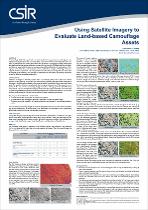
| dc.description.abstract | A camouflage field trial experiment was conducted. For the experiment several targets were deployed along tree lines and in an open field. Some of the vehicles were deployed with a variety of camouflage nets, while others were left uncovered. Unobstructed target panels were also deployed and served as calibration targets. During the trial, CSIR Defence, Peace, Safety and Security acquired both airborne and spaceborne (QuickBird, Spot 5 and Radarsat 1) imagery over the trial sites, and conducted extensive calibration and ground truthing activities in support of these acquisitions. This study further describes the processing that was done after acquisition of the datasets. The goal was to determine the best image processing techniques to use for effective camouflage detection | en |
| dc.language.iso | en | en |
| dc.subject | Camouflage | en |
| dc.subject | Satellite images | en |
| dc.subject | Image processing | en |
| dc.subject | Camouflage nets | en |
| dc.subject | AIC 2006, CSIR Conference Centre, Pretoria, South Africa, 27 – 28 February 2006 | en |
| dc.title | Using satellite imagery to evaluate land-based camouflage assets | en |
| dc.type | Conference Presentation | en |
| dc.identifier.apacitation | Baumbach, J., & Lubbe, M. (2006). Using satellite imagery to evaluate land-based camouflage assets. http://hdl.handle.net/10204/1566 | en_ZA |
| dc.identifier.chicagocitation | Baumbach, J, and M Lubbe. "Using satellite imagery to evaluate land-based camouflage assets." (2006): http://hdl.handle.net/10204/1566 | en_ZA |
| dc.identifier.vancouvercitation | Baumbach J, Lubbe M, Using satellite imagery to evaluate land-based camouflage assets; 2006. http://hdl.handle.net/10204/1566 . | en_ZA |
| dc.identifier.ris | TY - Conference Presentation AU - Baumbach, J AU - Lubbe, M AB - A camouflage field trial experiment was conducted. For the experiment several targets were deployed along tree lines and in an open field. Some of the vehicles were deployed with a variety of camouflage nets, while others were left uncovered. Unobstructed target panels were also deployed and served as calibration targets. During the trial, CSIR Defence, Peace, Safety and Security acquired both airborne and spaceborne (QuickBird, Spot 5 and Radarsat 1) imagery over the trial sites, and conducted extensive calibration and ground truthing activities in support of these acquisitions. This study further describes the processing that was done after acquisition of the datasets. The goal was to determine the best image processing techniques to use for effective camouflage detection DA - 2006-02 DB - ResearchSpace DP - CSIR KW - Camouflage KW - Satellite images KW - Image processing KW - Camouflage nets KW - AIC 2006, CSIR Conference Centre, Pretoria, South Africa, 27 – 28 February 2006 LK - https://researchspace.csir.co.za PY - 2006 T1 - Using satellite imagery to evaluate land-based camouflage assets TI - Using satellite imagery to evaluate land-based camouflage assets UR - http://hdl.handle.net/10204/1566 ER - | en_ZA |


